Orthomosaic Mapping & Drone Survey Mapping — North East
Accurate, georeferenced aerial map data for construction, land, planning and infrastructure projects across the North East. MGS Drone Surveying produces professional orthomosaic maps and 2D site overviews using industry-standard photogrammetry workflows.
What Is Orthomosaic Mapping?
An orthomosaic is a highly accurate, georeferenced aerial map produced by stitching together dozens or hundreds of overlapping drone images. Unlike a standard aerial photograph, an orthomosaic is spatially corrected — meaning it can be used for accurate measurements, area calculations, site planning and GIS analysis.
MGS Drone Surveying captures site imagery at low altitude for high Ground Sample Distance (GSD), producing maps with centimetre-level detail that can be used directly in QGIS, AutoCAD and other professional tools.
What's Included
Multi-pass drone survey of the target site
High-overlap image capture for accurate photogrammetric processing
Processed orthomosaic map output (GeoTIFF / PDF)
Digital Surface Model (DSM) where required
Site plan and overview map suitable for planning and reporting use
QGIS-compatible output for further analysis
Applications
Construction site overviews and progress mapping
Land and boundary surveys
Planning application support
Infrastructure inspection and asset mapping
Volumetric and cut-and-fill analysis for earthworks
Environmental and land management surveys
Real Project Example
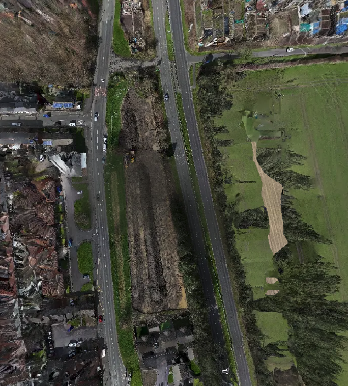
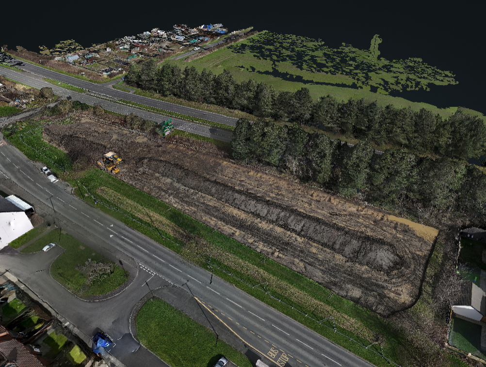
Annitsford Development Site — Tanaff Developments
As part of MGS Drone Surveying's ongoing development of mapping and photogrammetry capabilities, a full drone survey and orthomosaic map was produced for a new development site at Annitsford. The imagery was processed using professional photogrammetry software to produce a georeferenced orthomosaic and detailed site plan, exported and visualised in QGIS. The resulting map provides accurate spatial data across the site and demonstrates the detail and usability of MGS drone mapping output for construction and development clients.
Mapping and photogrammetry services are an active and growing part of the MGS offering — get in touch to discuss your specific requirements.
Why Use Drone Mapping?
Faster and safer than traditional ground survey methods for large areas
Consistent, repeatable results across multiple survey dates
Data deliverables compatible with standard GIS and CAD tools
Scalable from small plots to large multi-hectare sites
Cost-effective alternative to manned aerial survey
📞 Discuss Your Mapping Requirements — MGS Drone Surveying
Contact us to find out how drone mapping can support your project.